|
Informations sur la station |
|
|
|
| Nom de la station |
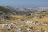
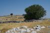
Pic Naxos-Zeus | |
| Localité |
Naxos - Filoti |
| Pays |
Grèce |
| Région |
Nomos Kykladon |
|
| Latitude (WGS 84) |
37°01'54.1415'' | |
| Longitude (WGS 84) |
25°30'17.6923'' | |
| Projection d'origine |
WGS84 |
| MGRS (WGS 84) |
35SLA6702499434 |
| Altitude |
900m |
| Zone |
1km² |
|
| Confidentialité |
Publique |
| Groupe de travail | Données privées |
| Encodeur |
Claude DOPAGNE, le 07-01-2012 |
| Modification |
Claude DOPAGNE, le 07-01-2012 |
|
|
|