|
Informations sur la station |
|
|
|
| Nom de la station |
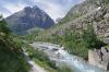
Le Carrelet | |
| Localité |
La Bérarde |
| Pays |
France |
| Région |
Rhone-Alpes |
|
| Latitude (WGS 84) |
44°54'29.7891'' | |
| Longitude (WGS 84) |
6°18'41.3380'' | |
| Projection d'origine |
WGS84 | |
| MGRS (WGS 84) |
32TKQ8776576277 |
| Altitude |
1900m |
| Zone |
1km² |
|
| Confidentialité |
Publique |
| Groupe de travail | Données privées |
| Encodeur |
Claude DOPAGNE, le 09-10-2012 |
| Modification |
Claude DOPAGNE, le 09-10-2012 |
|
| Sous-stations : | |
|
|
|