Presentation
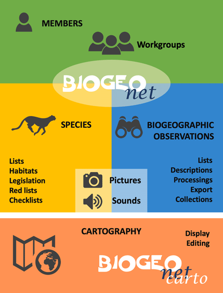
The database, BIOGEOnet, is organized around three axes illustrated in the diagram below: Members, species and biogeographical Observations.
Two levels of access to BIOGEOnet are defined:
- The general public: limited access to data *
- Members: Login and password (full access to member data and limited to other data)
The biogeographical data contained in BIOGEOnet is accessible to the general public within the privacy limits defined by the data-owning members. Two levels of confidentiality are defined: free data and private data. Each time a member can add, modify, delete and/or export these own data. A member cannot change the data that it does not own. Members can also organize themselves into working groups for easier sharing of data within them.
The ' biogeographical observations ' data are organized in the following way:
- Definition of the basic characteristics of the place of observation: geographical coordinates (choice of coordinate system and possibility to point directly to a map the precise location), locality, country, altitude, confidentiality, etc.
- Optional definition of additional characteristics (data) of the observation site fully configurable by the user. Depending on location by geographical coordinates, BIOGEOnet offers some additional data that the user can validate or not. These data are for example: biome, soil, soil occupancy, rainfall, habitats, etc.
- Association of observed species (from a proposed or free list) in relation to the place of observation, and definition of the date of observation and some other parameters (some are optional) such as the number of individuals, the observer, the determinant, the confidentiality, etc. Additional data can also be defined by the user (temperature, behaviour, etc.).
- Collection of observed individuals (optional). Setting the collection name and associated parameters. Possibility to load images, in high definition, of individuals put in collection (herbarium boards for example). Association of comments, bibliographic notes, etc.
- Association of photographs for both the observation sites and the species observed in them.
BIOGEOnet also manages the species lists. These are classified in a pragmatic way by drawing on the taxonomy. Each species listed can be associated: synonymy, vernacular names, checklists, legislation, links with other species (parasitism, consumer, etc.), photos, sounds, images of individuals put in collection (herbarium sheet e.g.).
BIOGEOnet Carto is a mini cartographic portal that allows you to view the data stored in the BIOGEOnet database in overlay of different maps and map data sets. For each station, editing tools allow you to draw polygons and define their attributes.
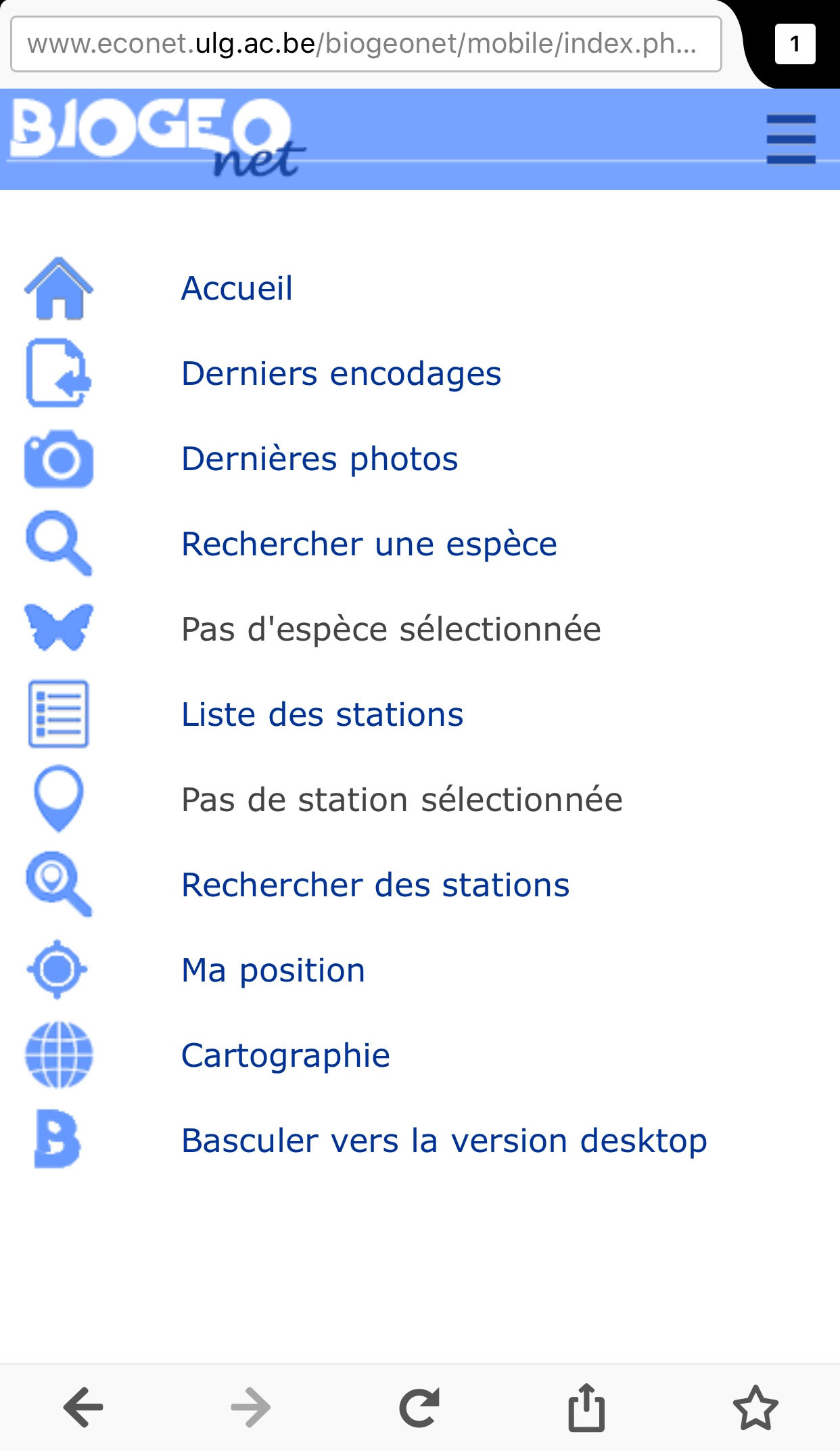
BIOGEOnet Mobile is the version of the site adapted to smartphones. This is displayed automatically when connecting with this type of hardware. The features are reduced compared to the desktop version. Nevertheless, the main functions of consultation and encoding of new observations (possibility to use the GPS of the smartphone) are available. It is possible to switch to the full version.
* 
Public data is subject to the standard Creative commons :
Attribution - You must give appropriate credit, provide a link to the license, and indicate if changes were made. You may do so in any reasonable manner, but not in any way that suggests the licensor endorses you or your use.
NonCommercial - You may not use the material for commercial purposes.
NoDerivatives - If you remix, transform, or build upon the material, you may not distribute the modified material.


 The first developments of this project began in 1986 on a 'Commodore 64' platform. Initially the aim was to compile, in a database, the botanical and zoological observations made in the field and usually recorded in a booklet. The interest was to be able to search, sort and analyze these thousands of data using this new tool of the time: the computer. At the beginning of the 1990s, the database migrated to the 'PC' world, initially in DOS in 'BASIC' and then quickly under 'WINDOWS' via VirtualBasic. It is at this time that the project takes the name of BIOGEO. From this moment development accelerates and many functionalities enrich the project (analyzes, statistics, mapping, sharing, catalogs, etc.). At the end of the 1990s, BIOGEO was used by the provinces of Limburg and Antwerp to compile their very large data. In Wallonia, asbl 'Etudes & Environnement' actively supports the project and uses BIOGEO to create an ornithological database. Beginning of the 2000s BIOGEO is used by aCREA-ULiège in scientific research. In 2006, the project was launched on the Internet, became independent of the operating system and is now called BIOGEOnet. 2016 sees a specific interface for smartphones that takes into account the specificities of this type of hardware in particular by using the positioning functions (GPS). In 2017, the site migrates to an https server.